

- Aboriginal History
- Cemeteries
- Hospitals
- Hotels
- Maps of the Goldfields
- Military
- Miners
- Miscellaneous
- People
- Places on the Goldfields
- Place Index A-Z
This website is dedicated to the memory of my two dear friends Sandy Duncan and Shyama Peebles who both passed away in 2012.
Linden > Linden
Linden
Western Australia
Latitude : 29 18 S Longitude : 122 26 E
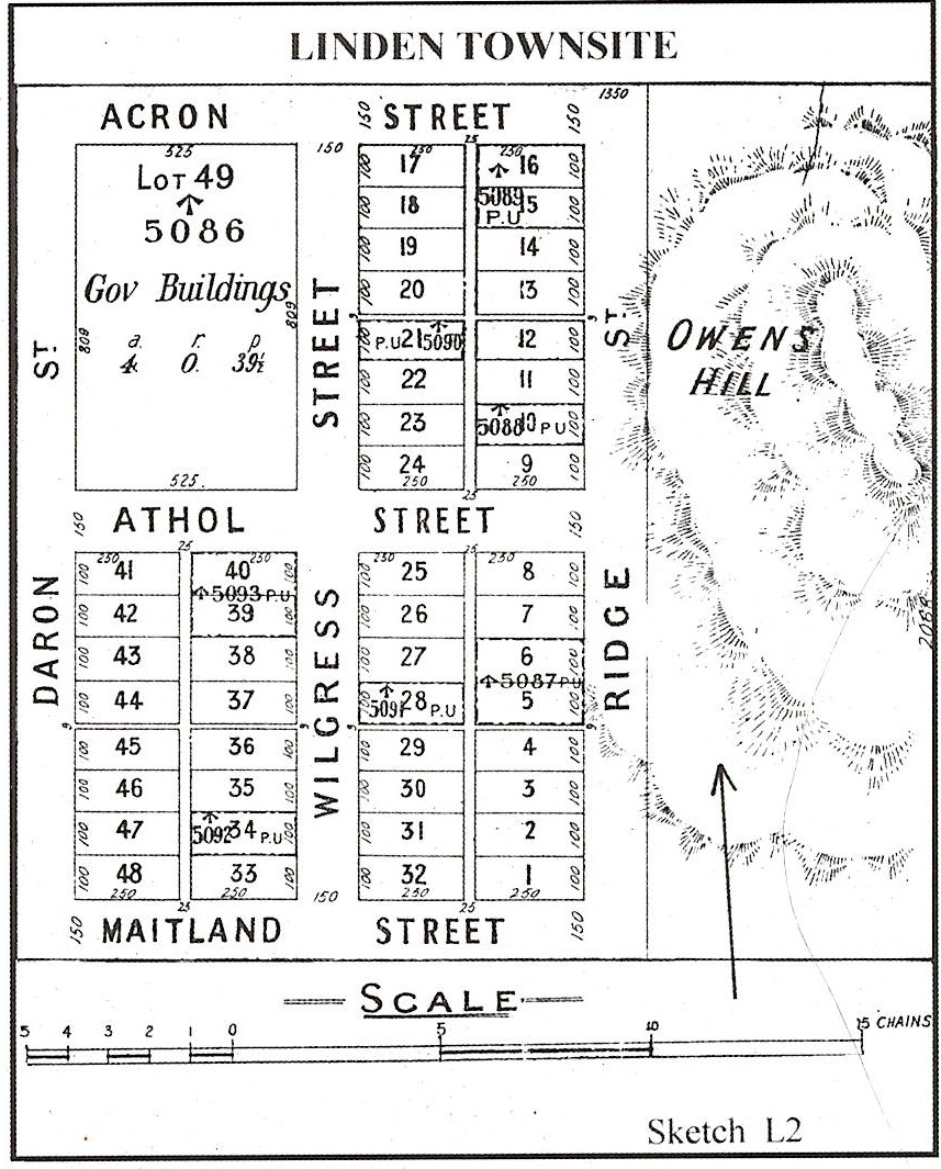
Linden is an abandoned townsite in the eastern goldfields, 75 km south of Laverton on the southern side of Lake Carey. Gold was discovered in this area in the mid 1890s, and in 1896 Warden Owen suggested a townsite be created. Owen used the name Griffithston for the place, but departmental officers in the Department of Lands and Surveys felt this name unsuitable, and suggested Linden instead. Mount Linden is located just to the south of the townsite, and has been shown on maps since 1897. It is not known who the name commemorates, although it was probably prospector James Linden. The townsite of Linden was gazetted in 1897.
.jpg)
Along the road to Linden where the stunted gum trees wave
Is the land of memories, a lonely miners grave
A hallowed spot, ‘Where all who pass should stop’
And tribute pay
Lonely he rests a rest he must until
The final call of judgement to awaken at God’s will
Now the Eucalypts regrowing on the field that bears their name,
Hide scars, ‘wounds of the golden game’.
Churned up ground akin to the war torn fields of France
Silent evidence of a maddened golden dance.
Sleep in peace old fellow, you have played your part,
Now WA is growing with a great pulsating heart.
The awakening of a people to the richness of their land.
I know its dry and dusty and how the sun glares down,
But my memories there are cherished of a lot of mates who perished
Far from the sight of town.
Reccomended Reading:-
.jpg)
The Linden Girl, the story of outlawed lives by Pamela Rajkpwski
| Return to Linden | Next Record Linden Cemetery |